Live tracking and passage briefs
Yacht delivery tracking
You can see your yacht at sea, every day.
On every delivery you can see online where your yacht is, right now. You, and anyone you share the link with, can open it on a phone and see her position, her speed and the whole track since she left port. You can also send the crew a message by satellite.
Three sources, one track
Positions come from three places. The first is AIS, the same system ships use. Far from land AIS often drops out, and on board an antenna, a cable or most often a splitter can fail. So the skipper also carries a Garmin inReach satellite tracker, which works in the middle of the ocean. It normally sends a position every hour, up to the satellites and on to our tracking page. On long ocean legs, far from the coast, we switch it to every four hours. The third source is a small app on the skipper's phone. It runs in the background, hardly touches the battery and sends a GPS position once an hour.
Now and then one of them stops working. The inReach runs out of battery, the phone is out of range. One of the three almost always gets through.
Our own system has run on every delivery since summer 2026. Before that we tracked deliveries with SPOT and Garmin inReach satellite trackers and satellite phones. A few of those older tracks are below the new ones, with the story of how we used to talk to a yacht at sea.
The office watches the track too
From the position and progress of the yacht, our office sends the skipper navigational warnings for the next part of the passage. This season that meant a dead whale, an abandoned fishing boat and a drifting buoy. Today we have Starlink on board, so staying in touch with the crew is easy. Starlink draws a lot of power, so on long passages, or when the yacht's batteries are weak, the skipper switches it on from time to time rather than leaving it running.
It is a real back office, not just a map. We book the marinas, find a workshop when something breaks, arrange a Yanmar or Volvo Penta service when the engine needs it, and check flights and connections to the nearest airport for the crew.
Sample: from a real passage brief our office sent to the skipper. South Sardinia to Denia, June 2026:
Drifting dead whale. An 8-metre dead whale has been reported drifting southeast of Vilanova i la Geltrú. Latest position 41°00.00'N 001°53.50'E on 5 June at 16:02 UTC. It is drifting south and southwest and may cross your direct route.
Drifting fishing vessel. A disabled fishing boat is drifting out of control southeast of Cabo de Gata, reported at 36°25.77'N 001°26.8'W. Give it a wide berth and keep a radar watch if you pass south of the Balearics.
Firing exercise, 7 to 9 June. A 10 NM circle about 60 NM east of Alicante sits right on your rhumb line, active 06:00 to 18:00 UTC. Plan a detour to the north, closer to Ibiza and Formentera.
Recent passages, as the owners saw them
Tracks from our tracking page. We leave out yacht names for the owners' privacy.
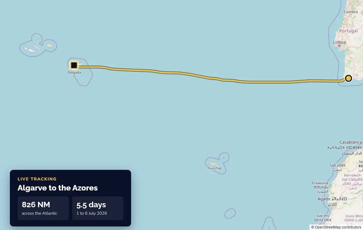
Algarve to the Azores. 826 NM in five and a half days, July 2026.
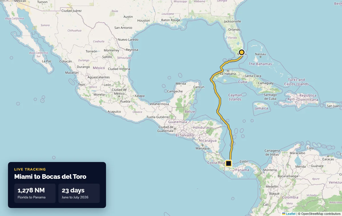
Miami to Bocas del Toro, Panama. 1,278 NM round the western tip of Cuba, June to July 2026.
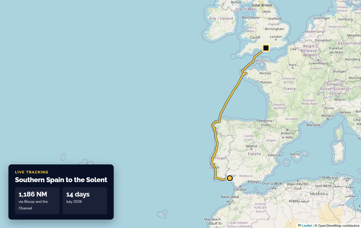
Southern Spain to the Solent. 1,186 NM across Biscay and up the Channel in 14 days, July 2026.
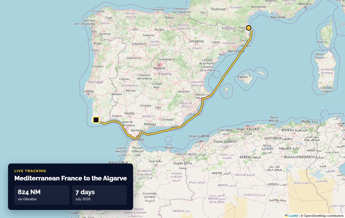
Mediterranean France to the Algarve. 824 NM through Gibraltar in 7 days, July 2026.
Before summer 2026: SPOT, Garmin inReach and Iridium
Satellite trackers carried by our skippers. Fewer positions, but the owner could still see the yacht on the other side of an ocean.
Before Starlink, talking to a yacht at sea meant an Iridium satellite phone. The signal was often weak and the modems struggled even with a text message, so we had a rule: if the skipper's reply had not come by 13:00, the office tried again. To keep weather messages short, we marked on a gnomonic chart where the yacht would be in 24, 48 and 72 hours and texted the forecast for each point. B.NNE28 meant: keep your speed, and at noon in two days expect 28 knots from the north-northeast. In the trade winds keeping your speed is the easy part.
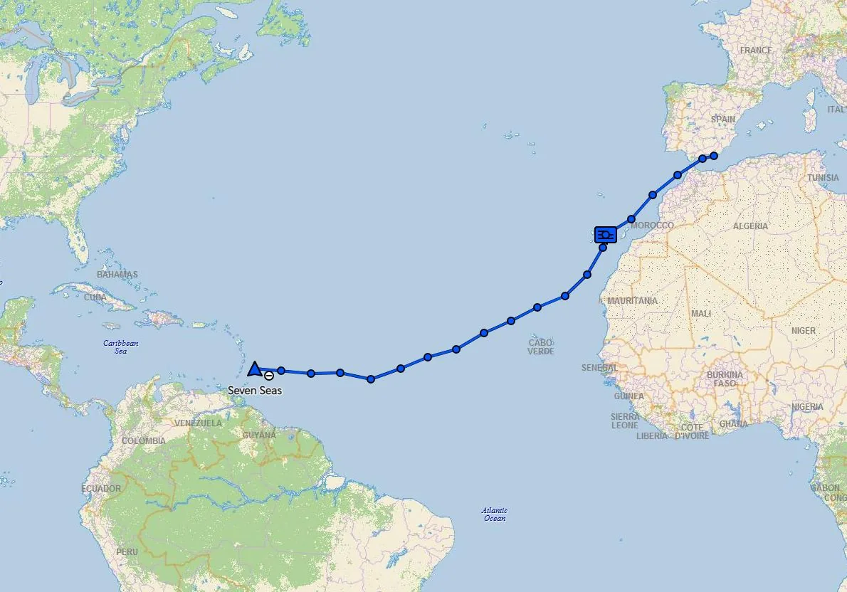
Almerimar to Barbados. Beneteau 57 via Tenerife, Garmin inReach, 2023. Read the story →
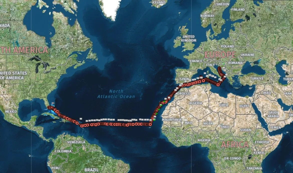
Mediterranean to Florida. Through Gibraltar, down the African coast and across the Atlantic.
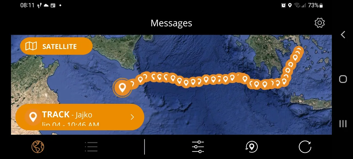
The Egg. That is what we called the orange SPOT tracker, here in its app on the skipper's phone. It worked well, as long as nobody put it in the wrong spot on deck or dropped a towel on it.
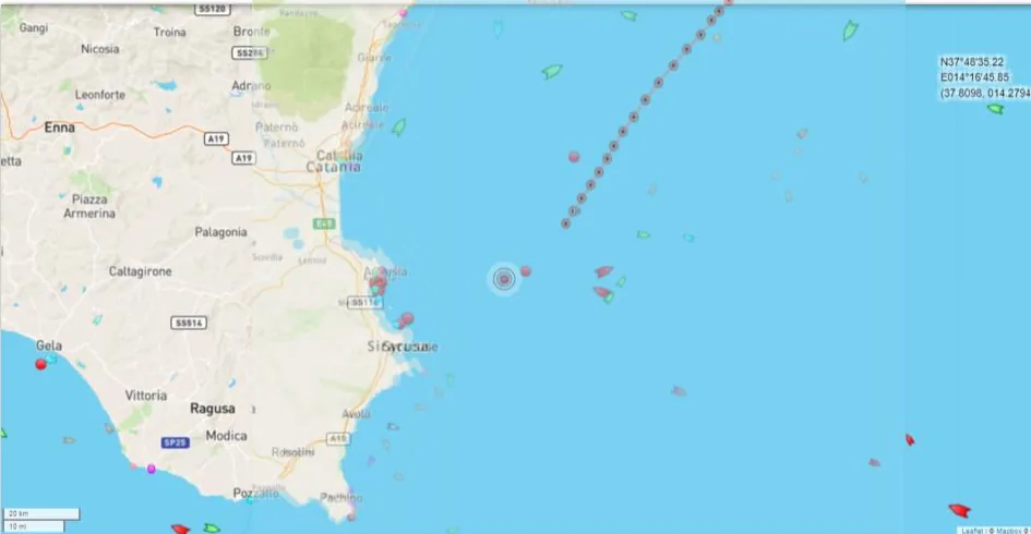
Off Syracuse, Sicily. Our track with the ship traffic around.
Want to follow your own yacht like this?
Tell us the boat, the route and the dates. A captain, not a call centre, replies within one working day.